


Analysis: Ayrotv.com
The map from 1890 reflects both technical limitations of cartography and historical-political biases prevalent during the European colonial era. Below are the key reasons for Africa’s diminished portrayal:
1. Map Projection Distortion
- Mercator Projection: Most 19th-century maps used this projection, which inflates the size of landmasses near the poles (e.g., Europe, North America) and shrinks equatorial regions like Africa. For example:
- Greenland (0.8 million km²) appears larger than Africa (30 million km²) on Mercator maps.
- Eurocentric Bias: The projection centered on Europe, reducing Africa’s visual prominence.
2. Colonial Fragmentation
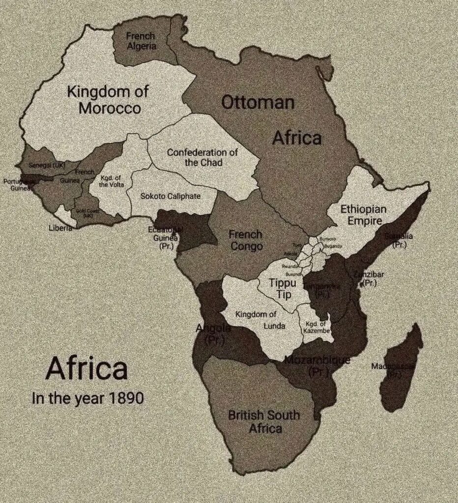
- Scramble for Africa: By 1890, European powers had divided Africa into colonies (e.g., French Algeria, British South Africa). The map emphasizes political divisions over geographical accuracy, making Africa seem fragmented and smaller.
- Labels and Borders: Overlapping colonial claims (e.g., French Guinea, Ottoman Egypt) clutter the map, obscuring the continent’s true scale.
3. Limited Geographical Knowledge
- Unexplored Interior: Much of Africa’s interior (e.g., Congo Basin, Sahara) remained unmapped by Europeans in 1890. Cartographers relied on incomplete data or speculative sketches, leading to inaccuracies.
- Coastal Focus: European maps prioritized coastal trade routes and colonies, neglecting the vast interior.
4. Political and Cultural Bias
- Eurocentrism: Maps from this era often portrayed Europe as the “center of the world,” marginalizing African landmasses.
- Colonial Propaganda: Smaller depictions of Africa reinforced the colonial narrative of a “primitive” continent needing European control.
5. Technological Limitations
- Pre-Satellite Era: Without modern tools like GPS or aerial surveys, 19th-century maps relied on rudimentary triangulation and traveler accounts, leading to errors.
- Ink and Paper Constraints: Detailed large-scale maps were expensive, so publishers often compressed Africa to fit colonial narratives.
Examples from the 1890 Map
- “British South Africa”: Exaggerated labels for colonies overshadowed the continent’s true size.
- “French Guinea” and “Ottoman Africa”: Fragmented political labels created visual clutter, masking Africa’s unity.
- Missing Features: Vast regions like the Sahel or Great Lakes were omitted or simplified.
Conclusion
Africa’s “small” appearance on the 1890 map stems from cartographic distortions, colonial agendas, and technological gaps. Modern maps corrected these biases, revealing Africa’s true scale as the second-largest continent.
Key Takeaway: Historical maps are cultural artifacts—they reflect power dynamics, not geographical reality.


 was a singer, songwriter, composer, poet, and musician who pushed Somali music forward.")
